MARINE TRACKING 162 MHz DX
Most boats use transponders which send all their
position and navagation data, plus cargo and type of vessel information. The max
TX power is 12 Watts with omni directional vertical antennas. Obviously ship
transmissions originate from just above sea level. This just goes to show that
height is not might when it comes to tropo. Marine tracking can also be used for
high MUF Sporadic E detection, esp useful across water paths.
162 MHz Marine Tracking can be an excellent indicator for paths across water.
They are just like floating beacons.
Im using a Shine Micro SM161R-2 receiver and 4 x 11 ele
yagis made by DUAL ANTENNAS at around 55 ft. The pre-amp is also made by DUAL
ANTENNAS specifically for the 162 MHz band.
Max reception here so far is 2938 km, my aim is to break the 3000 km tropo
barrier.
![]()
![]()
TABLE OF AIS OPENINGS TO MY LOCATION: No longer logging openings
| OPENING DATE | LOCATION/S | MAX - MIN DISTANCE | NUMBER OF VESSELS | NUMBER OF SIGNALS | COMMENTS |
| 25.01.14 | G.A. Bight | 2165 km - 959 km | 14 | 355 | Sporadic E opening :) |
| 25.01.14 | Bight Path | 1296 km | 6 | 10 | Start high cell |
| 19.01.14 | Dunsborough WA. | 2938 km | 40 | 2000 | Start high cell |
| 12.01.14 | middle Bight | 1567 km | 35 | 1100 | Start high cell. |
| 31.12.13 | Bight Path | 2116 km | 9 | 897 | |
| 29.12.13 | Adelaide, Spencer Gulf | 901 km | 14 | 118 | Cold front swept through |
| 03.11.13 | Bight Path | 1231 km | 16 | 282 | Very start of high cell |
| 31.10.13 | Bight Path | 1447 km | 9 | 106 | Slow high cell |
| 04.10.13 | Bight Path | 1580 km | 4 | 30 | First summer type High |
| 25.07.13 | Adelaide | 1067 km | 66 | 3196 | Blocked by cold front |
| 22.01.13 | Adelaide area | 902 km | 14 | 247 | West side of low trough |
| 19.01.13 | Adelaide area | 900 km | 10 | 233 | New high cell |
| 14.01.13 | Adelaide | 1356 km | 4 | 11 | High cell |
| 02.01.13 | East of Esperance | 1985 km | 89 | 19,020 | Tail end of a Duct |
| 29.12.12 | Esperance | 2298 km | 52 | 10,015 | New high cell |
| 10.09.12 | Kangaroo Is area | 994 km | 45 | 4564 | High cell moving through |
| 09.09.12 | Bight Paths & Adelaide | 2627 km | 11 | 181 | Bight path to Albany |
| Day E skip 3.1.12 | Bight & sth of Tas | 1861 - 904 km | 5 | 53 |

Above : 03.01.12 received 5 ships via Sporadic E propagation. Max 1861 Km & minimum 904 Km. Antenna fixed SSW.
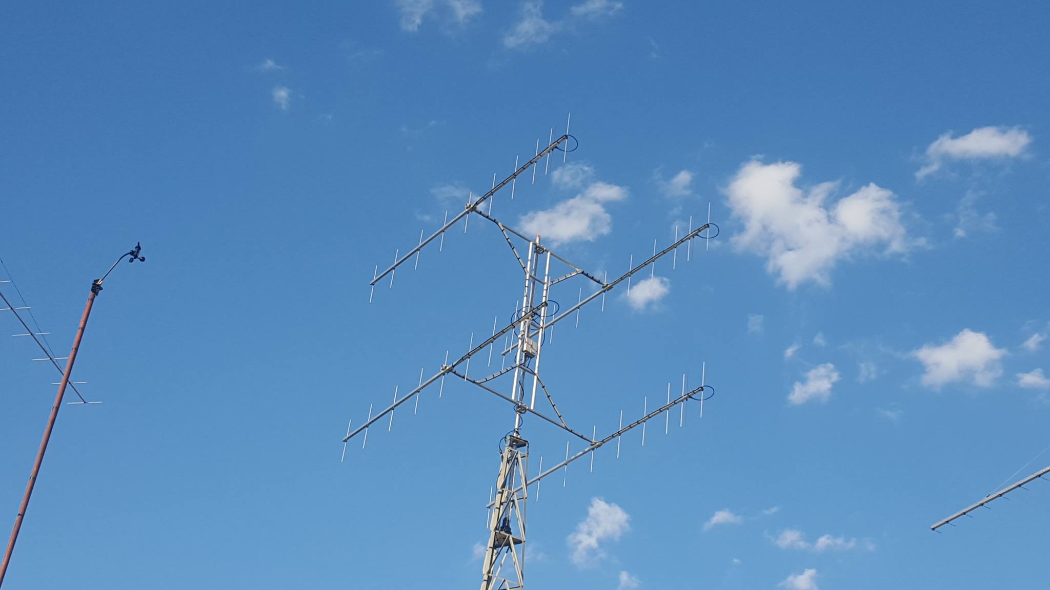
Above Photo : New 162 MHz Marine yagi array as at Nov 2017. Yagis by Dual Antennas.
~INFORMATION ON
THIS SITE MAY ONLY BE REPRODUCED WITH PERMISSION,
LEIGH RAINBIRD VK2KRR~
Copyright ©Leigh Rainbird